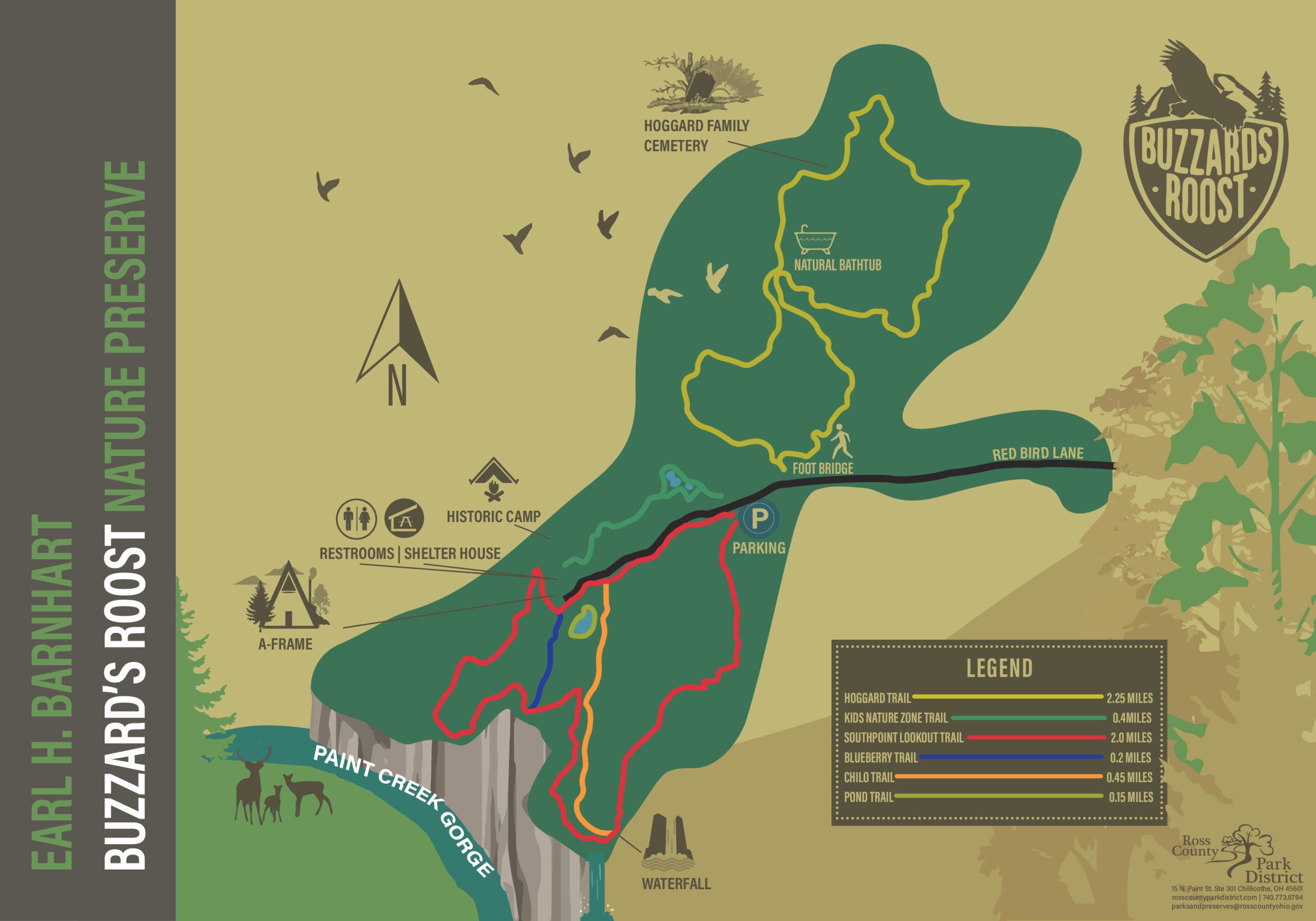
The Earl H. Barnhart "Buzzard's Roost" conserves nearly 1,200 acres of the most rugged and scenic country in this area. The first 373 acres were generously donated by Jean Barnhart in memory of her late husband Earl in 2000, for whom the park is named. Since then, over 5 miles of forested hiking trails have been constructed. Hikers visit from the county and beyond to venture past ponds, vernal pools, the crumbling remains of old homesteads, and deep, wooded ravines.
A walk on the renowned South Point Lookout Trail offers magnificent views of the vertical cliffs of sandstone and shale that descend into Paint Creek Gorge. Paint Creek did not always flow through this valley, but when a dam of ice and sediment blocked Paint Creek’s original course a couple of miles from here during the last glacial maximum, Glacial Lake Bourneville was formed behind the dam and eventually overflowed through a low saddle in the hills. The meltwater that flowed over the spillway carved out the present-day Paint Creek Gorge. The spectacular cliffs of sandstone and shale have been eroding for 25,000 years!


